
Supply in Kazakhstan
KEG TRK supplies equipment diagnostics solutions (Skyline Software) across Kazakhstan: Almaty, Astana, Karaganda, Ust-Kamenogorsk, Aktobe and other regions. Official warranty, monitoring system design, installation, commissioning and personnel training.
Key features
Applications and resources
Industry solutions, landing pages and articles on TerraExplorer Desktop — 3D GIS platform and digital twin
Typical tasks
- Digital twin of an industrial site, open pit or refinery
- Monitoring mining operations and stockpiles from drone data
- Planning and tracking infrastructure construction
- Inspecting linear assets — pipelines, power lines, roads
- Shared decision-making on a single 3D model of the enterprise
Overview
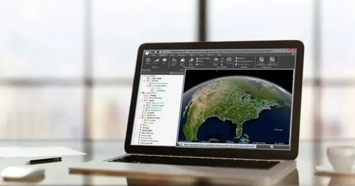
TerraExplorer Desktop is Skyline Software's flagship 3D GIS platform for building and analyzing a digital twin of a territory or asset. It combines terrain, satellite and drone imagery, photo-realistic 3D meshes, building BIM/CAD models, laser-scan point clouds and vector layers into one 3D scene, with a full toolset for measurement, analysis and presentation.
For an industrial site this means a single visual model of the plant, pit, pipeline route or power facility — built from real geospatial data rather than schematic drawings.
Three levels of capability
- TerraExplorer Viewer — view and basic analysis of a ready-made 3D scene;
- TerraExplorer Plus — loading and editing all layer types, advanced analysis tools, multi-user collaboration;
- TerraExplorer Pro — publishing projects to SkylineGlobe Server, converting and optimizing models for streaming.
Analysis tools
Distance, area, volume, terrain profile, line of sight, viewshed, shadow analysis, time-based model comparison, cross section — a full set for engineering and management decisions, directly in the 3D scene, without switching to separate GIS tools.
Inspection against source photos
A dedicated tool lets you view a PhotoMesh 3D model alongside the source photos it was built from. You can mark a defect (a crack, corrosion, an area needing repair) right on the model and instantly see the high-resolution source frame — no repeat site visit needed.
KEG TRK is Skyline Software's partner in Kazakhstan: TerraExplorer licensing, consulting on digital-twin deployment, and integration with existing drone and laser-scan data.
Technical specifications
| Manufacturer | Skyline Software |
| Line | TerraExplorer (Viewer / Plus / Pro) |
| Type | Desktop 3D GIS platform |
| Data formats | 3D mesh, BIM, CAD, Lidar point cloud, imagery, elevation, feature layers |
| Analysis tools | Distance, volume, terrain profile, line of sight, shadow, model comparison, cross section |
Applications
Manufacturer
Skyline Software
Desktop 3D GIS platform for building, viewing and analyzing a site's digital twin: terrain, orthophoto, 3D meshes, BIM/CAD, point clouds — in one scene
Key specifications
- Manufacturer
- Skyline Software
- Line
- TerraExplorer (Viewer / Plus / Pro)
- Type
- Desktop 3D GIS platform
- Data formats
- 3D mesh, BIM, CAD, Lidar point cloud, imagery, elevation, feature layers
- Analysis tools
- Distance, volume, terrain profile, line of sight, shadow, model comparison, cross section
Official supplier in Kazakhstan
Related products

PhotoMesh — automated photogrammetry and 3D reconstruction
Fully automated photogrammetry: builds photo-realistic 3D meshes, orthophotos and point clouds from drone or ground photos, with no manual processing
- Skyline Software
- Photogrammetric 3D reconstruction software

TerraExplorer Fusion — web-based 3D geodata viewer, no install
The web edition of TerraExplorer: view, measure and analyze a high-resolution 3D digital twin right in the browser — no install, on Windows, Mac, Linux
- Skyline Software
- TerraExplorer Fusion (Viewer / Plus)

SkylineGlobe Server — 3D geodata publishing and streaming server
Private cloud server for storing, managing and streaming 2D/3D geospatial data — compatible with TerraExplorer, Esri, Cesium and QGIS
- Skyline Software
- Geodata publishing and streaming server
Need advice?
Our specialists will help you choose the optimal TerraExplorer Desktop — 3D GIS platform and digital twin configuration for your equipment.
Related articles
All articles →Skyline Software 3D GIS & Digital Twins in Kazakhstan: From Surveying to Enterprise Asset Management
Practical guide to implementing Skyline Software 3D GIS in Kazakhstan: PhotoMesh photogrammetry, 3D Gaussian Splatting, SkylineGlobe Server, and TerraExplorer analysis for mining and infrastructure.

Pit Digital Twin: How PhotoMesh and TerraExplorer Calculate Stripping and Stockpile Volumes from Drone Data
A monthly survey crew's pit measurements are already stale by the time the report lands on a chief engineer's desk. Here's how PhotoMesh, TerraBuilder, and TerraExplorer turn routine drone flights into an accurate digital twin for weekly volume tracking.